Reliable marine navigation isn’t only for big ships. Every boater, whether you’re cruising for the weekend or heading out to fish, benefits from the confidence that comes from a solid navigation system. Over the years, I’ve tried quite a few setups, and I’ve found that picking the right system really depends on the kind of boating you do, your boat size, and your budget. This article breaks down what to look for, gives you a rundown of the top marine navigation options, and shares some tips that will help you make smart choices for your next outing.
Why Modern Marine Navigation Matters
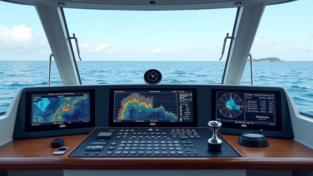
Modern marine navigation has moved way beyond paper charts and compasses. With today’s electronics, staying safe on the water is a whole lot easier. Whether you’re in open sea or winding through narrow coastal passages, a dependable chartplotter or navigation app will keep you on the right path. These systems often pull in GPS, depth data, and even weather updates in real time, so you spend less time worrying about where you are and more time enjoying the ride.
For me, knowing exactly where I am, even in fog or at night, makes boating way more relaxing. It also helps avoid running aground, missing a tricky turn, or getting caught in a “where the heck are we?” moment. Not only does modern equipment keep you safe, but it also makes it easier to plot courses, mark favorite fishing spots, and share your adventures with friends.
Getting Started with Marine Navigation
If you’re gearing up to outfit your boat, you might be wondering where to begin. There are three main types of electronic navigation options most boaters use today:
- Dedicated Chartplotters: These standalone units are mounted at the helm. They usually have crisp displays and are built for marine environments.
- Multifunction Displays (MFDs): These systems combine chartplotter, radar, sonar, and sometimes autopilot into one touchscreen device.
- Mobile Device Apps: There are plenty of apps for iOS and Android that can turn your phone or tablet into a powerful navigation tool, especially when paired with a waterproof case and a backup battery.
No single answer fits everyone. A lot of smaller or trailerable boats do just fine with an iPad running Navionics or Aqua Map. Offshore cruisers, however, will want the reliability and power of a wired-in MFD with backup systems in place. If you plan to regularly head out of sight of land, durable hardware can truly make the difference should the weather turn nasty. For infrequent or casual trips, starting with a quality app is much less expensive and surprisingly capable these days.
Top 10 Marine Navigation Systems for Boaters
Here’s my list of the top 10 marine navigation systems. I’ve gathered these based on personal experience, boater reviews, and features that matter most out on the water. Each system suits a different use case, whether you’re a coastal sailor, a freshwater angler, or a bluewater cruiser.
- Garmin GPSMAP 943xsv
Pros: Bright 9″ display, fast processor, supports radar/sonar, detailed BlueChart g3 maps, and wireless connectivity.
Cons: Pricey; some features need additional Garmin accessories.
Rating: ★★★★☆ - Raymarine Axiom+ 9
Pros: Super responsive touchscreen, intuitive interface, Lighthouse charts, Wi-Fi enablement, solarfriendly screen.
Cons: Slight learning curve expanded features require more investment.
Rating: ★★★★☆ - Simrad GO9 XSE
Pros: Easy to use touchscreen, great for both sailing and powerboats, strong sonar options, preloaded maps.
Cons: Some advanced settings take practice to master.
Rating: ★★★★☆ - Lowrance Elite FS 9
Pros: User friendly, high-detail maps, touchscreen and buttons, good fish finding tools.
Cons: Occasional lag with complex charts or overlays.
Rating: ★★★★☆ - B&G Vulcan 9
Pros: Sailor focused routing, good display in daylight, affordable for serious cruising.
Cons: Limited advanced sonar and radar integration.
Rating: ★★★☆☆ - Standard Horizon GX6000 VHF with GPS & AIS
Pros: Combines VHF radio, GPS, and AIS receiver, essential for safety.
Cons: Not a full chartplotter, works better as a backup or companion unit.
Rating: ★★★☆☆ - Navionics Boating App (Mobile)
Pros: Covers both Android and iOS, detailed charts, affordable yearly subscription, autorouting feature.
Cons: Relies on device battery and screen brightness is tough in direct sun.
Rating: ★★★★☆ - Aqua Map Marine Navigation App
Pros: Excellent cost-to-performance, great chart updates for small boats and kayaks, user friendly.
Cons: No sonar integration; works best nearshore with cell signal for weather updates.
Rating: ★★★★☆ - Furuno GP1971F
Pros: Highly rated for reliability, solid build, integrates with radar and sonar, good for commercial or larger boats.
Cons: Pricey and not as visually polished as some others.
Rating: ★★★★☆ - Humminbird HELIX 7 G4N
Pros: Compact, affordable, really strong fish finding tech, easy to use.
Cons: Screen a bit smaller, mapping isn’t as detailed as larger units.
Rating: ★★★★☆
Whether you’re a seasoned captain or new to boating, each of these systems is tailored for different needs. For example, if you frequently fish inland lakes, the Humminbird HELIX offers outstanding fish finding at a reasonable price. For ocean crossings, the stability and integration capabilities of the Garmin or Raymarine units shine. Mobile apps have rapidly caught up to hardware for nearshore and weekend boating; just make sure you have weatherproof gear and a power backup. It’s always worth taking time to read up on the specific features and how these devices are performing for folks with boats like yours.
Features to Think About When Choosing a Navigation System
The “best” system is the one that’s right for your boat and your style of boating, not just the one with the most features or highest price tag. Here are some buying tips based on real-world use:
- Display Size and Brightness: Larger and brighter screens are easier to read in sunlight or rough seas.
- Waterproof and Rugged Design: Marine electronics need to shrug off spray, rain, and splashes.
- Chart Coverage: Make sure the maps cover the areas where you actually boat. Check for updates too.
- Ease of Use: Quick menu navigation and clear icons come in handy when you’re busy or the weather gets messy.
- Integration with Other Systems: Autopilot, radar, VHF, sonar, and AIS integration are pretty handy for more advanced setups, especially if you’re heading offshore.
- Budget: Prices run from a few bucks for a mobile app to a few thousand for full-featured MFDs. Set a budget and stick to the functions you’ll really use.
If you’re just cruising close to home, an app or a small chartplotter will do the trick. If you take your boat far offshore or plan on overnight passages, I recommend investing in a larger, permanently mounted MFD with at least a basic backup like a handheld GPS or navigation app. Factor in installation as well, since hardwired devices often need a bit of setup. Don’t forget to plan for future upgrades if you think you’ll want more features down the line.
Common Questions About Marine Navigation
I get a lot of questions from folks new to boating, or those looking to upgrade their systems. Here are the ones I hear most often, and my take on them:
Q: Do I really need an expensive chartplotter, or will my phone/tablet work?
A: For day trips and fair weather, your phone or tablet with a good case and app like Navionics or Aqua Map is absolutely usable. But for extended or offshore boating, a fixed-mount system is more reliable, especially in wet or bouncy conditions.
Q: How do I keep my navigation devices powered up?
A: Fixed systems run off your boat’s batteries, so keep them charged and maintain connections. For mobile devices, bring backup batteries or install a waterproof USB charger at the helm. Always carry a spare portable power bank if you rely on a phone or tablet, and keep cords secured away from water.
Q: What happens if my chartplotter fails?
A: Always have a backup. A handheld GPS or paper charts with a compass can save the day if the electronics go down. Knowing how to use these is really important. Practice simple dead reckoning skills in case your digital tools stop working at a crucial moment.
Q: Are free navigation apps any good?
A: There are some surprisingly solid free apps for basic navigation, but they rarely offer detailed charts or smart autorouting. If you boat regularly, it’s worth paying for the better chart data and full functionality. Paid apps often allow offline use so you won’t get caught short if a signal drops unexpectedly.
Extra Tips for Smooth Navigation
I’ve picked up some lessons (sometimes the hard way) that might save you a headache:
- Update Your Charts: New hazards, buoys, or marina info can appear every season. Updating your charts at least once a year could save you from grounding, or worse.
- Practice Using Backup Navigation: Spend a little time each season with your backup devices so if you ever need them, it’s not your first time using them in an emergency.
- Consider Local Conditions: Fog, tides, and strong currents all play a role. Your system should allow easy overlay of weather and tide data if you’re boating in dynamic water.
- Mount Smartly: Place displays where you can see them while steering, but away from drips and glare. A well-placed unit means you don’t have to take your eyes off the water for long.
- Stay Sharp: Even the best tech isn’t perfect, so stay attentive and keep an eye out for changes in the water or surprises that don’t match what’s on the screen. Relying too much on electronics can be tempting, but old school awareness remains key for safe boating.
With the right setup and a good routine, you’ll have a much smoother ride out there and reduce stress when the weather turns or you push into new territory. Sharing routes with fellow boaters or storing waypoints online makes your next trip even easier. Make it a habit to log your trips; it will help if you ever need to retrace your journey or track favorite locations for the future.
Choosing Your Next Navigation System
Picking a navigation system for your boat can look overwhelming at first, but it’s all about matching tools to the way you use your boat. Chartplotters and MFDs are awesome for those who head into open water or rely on high-level features. If you stick close to home and just want something straightforward, a navigation app paired with your phone or an affordable dedicated unit could be the best fit. Try to think about features that will actually come in handy, not just what looks fancy at the boat show.
If you’re curious about how different systems work on different boats, local dealers or online boater forums are worth checking for firsthand reviews. Safe boating always starts with solid navigation, and with just a little research, every boater can find a system that fits their own adventures. Wrapping up, getting set up with the right gear isn’t just about convenience, it’s about maximizing enjoyment and staying safe every time you hit the water.